
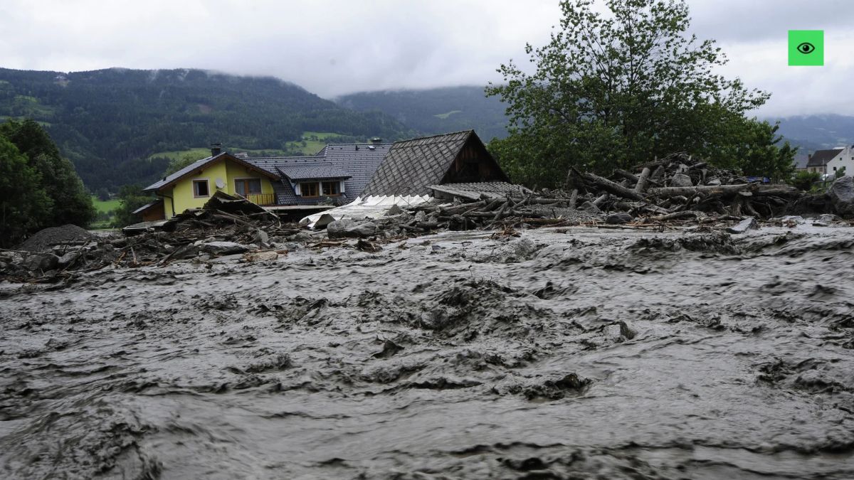
KOLKATA, 30th Oct: A glacial lake burst in Bhutan has triggered a flood emergency across parts of eastern India, placing West Bengal and Assam on high alert. More than 10,000 people have been evacuated from West Bengal’s Alipurduar district after nearly 7.4 million cubic metres of water surged out of Shintaphu Lake in northern Bhutan.
Indian authorities are monitoring the situation closely, with flood warnings issued across vulnerable areas near the international border. Schools have been converted into relief shelters, while residents in low-lying settlements have been urged to move to safer locations.
The immediate concern is the potential impact of the water surge on river systems flowing from Bhutan into India.
Bhutan Glacial Lake Burst Releases 7.4 Million Cubic Metres of Water
The glacial lake outburst occurred on Thursday evening at Shintaphu Lake, located below Wakila Mountain in Bhutan’s Gasa district.
According to reports from Bhutan’s state broadcaster BBS, residents were instructed to move to safety following the incident. Local media also reported infrastructure damage, although no deaths or injuries had been reported as of Friday morning.
The scale of the incident is significant. Nearly 7.4 million cubic metres of water, equivalent to approximately 3,000 Olympic-sized swimming pools, was released from the lake.
The precise extent of the downstream impact was not immediately known.
The outburst also damaged important local infrastructure in Bhutan. The Gasa Tshachu hot spring complex was reportedly washed away, while sections of the Punakha-Gasa highway suffered damage.
West Bengal Evacuates More Than 10,000 People
The situation quickly became a concern for Indian authorities because of the river network connecting Bhutan with downstream areas of West Bengal and Assam.
India’s Ministry of Jal Shakti issued a special advisory for both states, warning that floodwaters could reach the Indian border within six to eight hours.
In West Bengal, Alipurduar district witnessed a large-scale evacuation operation involving more than 10,000 people.
Authorities converted schools into temporary relief shelters to accommodate displaced residents.
Warnings were issued across Kumargram, Chengmari, Pakriguri and Bholka. Forest settlements and other low-lying areas across the Dooars region were also placed under watch.
The Dooars, situated along the Himalayan foothills, contain several vulnerable settlements where rising river levels can quickly create difficult conditions.
West Bengal authorities specifically warned residents living along the Sankosh River to remain alert and follow evacuation instructions.
State Minister of State for Home and Hill Affairs Bishal Lama confirmed that an alert had been sounded in parts of the Dooars, particularly near the Sankosh.
Forest Minister Manoj Kumar Oraon also appealed to residents through a video message on Facebook, urging them to evacuate.
He warned that the flood surge could reach Kumargram within an hour to an hour and a half.
By Friday morning, officials reported that the water flow had eased slightly. However, a red alert remained in force along the Sankosh River.
Why the Sankosh River Is at the Centre of the Flood Alert
Understanding the river network explains why the Bhutan glacial lake burst has raised concerns across the Indian border.
Shintaphu Lake feeds the Mo Chhu river, which flows into the Punatsangchhu before entering India as the Sankosh.
This interconnected river system creates a direct downstream route through which the released water can affect Indian territory.
The Sankosh is particularly important for authorities monitoring the situation in West Bengal.
Any significant increase in its water level could affect settlements situated along its banks, particularly those in low-lying areas.
However, the exact scale and duration of the downstream impact remained uncertain as officials continued monitoring the situation.
Assam Monitors Dhubri and Kokrajhar Districts
West Bengal is not the only state preparing for potential consequences.
Assam Chief Minister Himanta Biswa Sarma confirmed that the state government was closely monitoring vulnerable areas in Dhubri and Kokrajhar districts.
In a post on X, Sarma said authorities were tracking the possible impact of the glacial lake outburst across vulnerable revenue circles.
He also confirmed that government teams were maintaining contact with the National Disaster Response Force (NDRF) and other emergency agencies.
The teams were prepared to respond if the situation required intervention.
Sarma urged residents to remain alert, follow official updates and cooperate with local authorities.
The administration’s focus remains on preparedness and ensuring that vulnerable communities receive timely warnings.
What Is a Glacial Lake Outburst Flood?
A Glacial Lake Outburst Flood, commonly known as a GLOF, occurs when water stored in a lake formed by melting glaciers is suddenly released.
These lakes are often held back by natural barriers made of ice, rocks and accumulated glacial debris.
When such barriers fail, enormous volumes of water can rush downstream, carrying sediment, rocks and debris along the way.
The resulting floods can damage roads, bridges, settlements and other infrastructure.
Shintaphu is among Bhutan’s potentially dangerous glacial lakes. According to Daily Bhutan, the country’s official list identifies 17 such lakes.
However, authorities had not disclosed the specific cause of the latest outburst.
That distinction matters. While the event has been identified as a glacial lake outburst, the precise trigger remains unconfirmed.
Bhutan Incident Follows Deadly Glacier Disaster in Nepal
The latest incident also brings renewed attention to glacial hazards across the Himalayan region.
It comes approximately two months after a glacial collapse in Nepal on August 26.
During that incident, a large section of an overhanging glacier and rock broke away from Langtang Lirung mountain, sending water, ice and debris downstream.
The disaster reportedly killed more than 1,400 people, while thousands remained missing.
The two incidents highlight the potential consequences of sudden water and ice releases in mountainous regions.
For countries sharing Himalayan river systems, the impact of such disasters does not necessarily remain confined to the location where they originate.
Bhutan’s latest glacial lake outburst has demonstrated that reality once again, with communities across the Indian border preparing for possible flooding.
Authorities Remain on Alert as Floodwaters Are Monitored
By Friday morning, the water flow from the incident had reportedly eased slightly. Nevertheless, authorities in West Bengal and Assam continued monitoring vulnerable riverbank settlements.
More than 10,000 people had already been evacuated in Alipurduar, while relief shelters remained operational.
The red alert along the Sankosh also remained in force.
For now, the priority is clear: protect vulnerable communities, maintain communication between emergency agencies and ensure residents follow official instructions.
The eventual impact of the Bhutan glacial lake burst will depend on how the released water moves through the interconnected river systems.
Until authorities establish the full extent of the downstream impact, vigilance remains essential.
The Bhutan glacial lake burst is a reminder that natural disasters do not respect international borders. A lake may be located in Bhutan, but its downstream consequences can quickly become India’s problem.
The evacuation of more than 10,000 people in West Bengal demonstrates why early warnings and coordinated disaster response matter. River systems connect countries geographically, and emergency preparedness must reflect that reality.
India, Bhutan and other Himalayan nations need strong communication channels, reliable monitoring mechanisms and clearly defined evacuation procedures. Waiting for floodwaters to reach vulnerable settlements is not a strategy.

Any Comments?